About the project
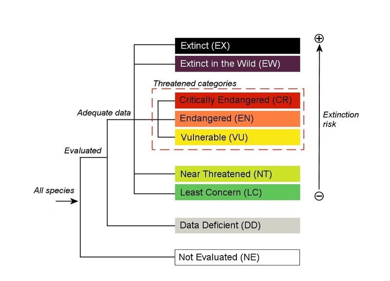
Our mission for this project is to visualise and educate people about species whose classification ranges from near threatened to completely extinct. This is an interactive map that can be used by anyone that wants to learn about species at risk based on their location, cause (threats), red list category and kingdom. It can also serve as a primary source for wildlife conservationists, who could potentially find areas and species that require action for biodiversity conservation. All data that was used in this project was provided by the International Union for Conservation IUCN.